


After a quiet start to the weekend, the Midwest and Northeast will have to endure another powerful storm bringing a plethora of weather hazards to post-holiday travel. The same system that brought flooding rain to California on Christmas Eve and Christmas Day will jet across the country, grab Gulf moisture and strengthen as it moves our way.
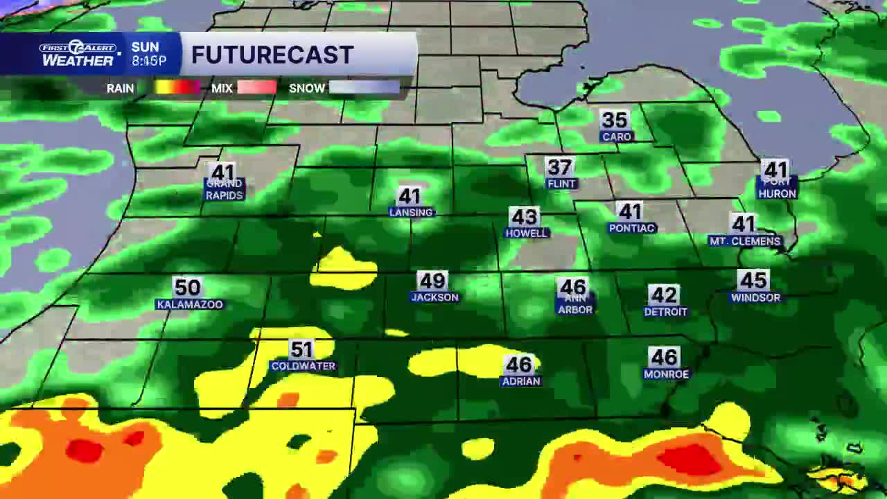
The storm will begin Sunday morning with rain moving across most of Michigan as late-day temperatures climb into the 50s here in Metro Detroit. Rainfall totals could exceed one inch by Sunday night across much of Metro Detroit. However, this unusual December warm-up won’t last long with a dramatic change arriving Sunday night. A powerful Arctic front will sweep through, causing temperatures to plummet and rain to transition to snow. Travel impacts can be expected across Michigan and the Great Lakes from Sunday night through Monday.We will be watching the possibility of dense fog and wet roads turning icy with the rapid drop in temperatures over a short period of time Sunday night into Monday morning.
The rapidly deepening low-pressure system will track across Lake Huron generating strong winds with gusts of 40 to 50 mph or higher across Lower Michigan on Monday. These wicked winds could bring whiteout conditions to start the week. While snowfall totals should fall between a dusting to two inches across Metro Detroit, the Upper Peninsula could experience blizzard conditions with totals closer to a foot by Monday evening. This powerful storm may wreak havoc on air travel across the Midwest and Great Lakes.Watch for delays at airports and stay alert for big impacts on local travel across Michigan.
As Arctic air settles in behind this storm on Monday, temperatures will only rise in the 20s with single digit wind chills to ring in the new year. Lake-effect snow and below-average temperatures can be expected across the Great Lakes through most of next week.
