


Planning your Day? Check out Day Planner Plus with Mike Taylor
I know it is early in the season, but over the next few days we will have to deal with temperatures and wind chills as low as they would typically be in mid January to early February. Make sure you wear the warmest outdoor clothing you have to stay warm outside. The arctic front tonight has opened the door for the coldest air of the season so far. Behind the front we will drop highs into the low 20s, but morning wind chills will be near 0°.
Check out the forecast:
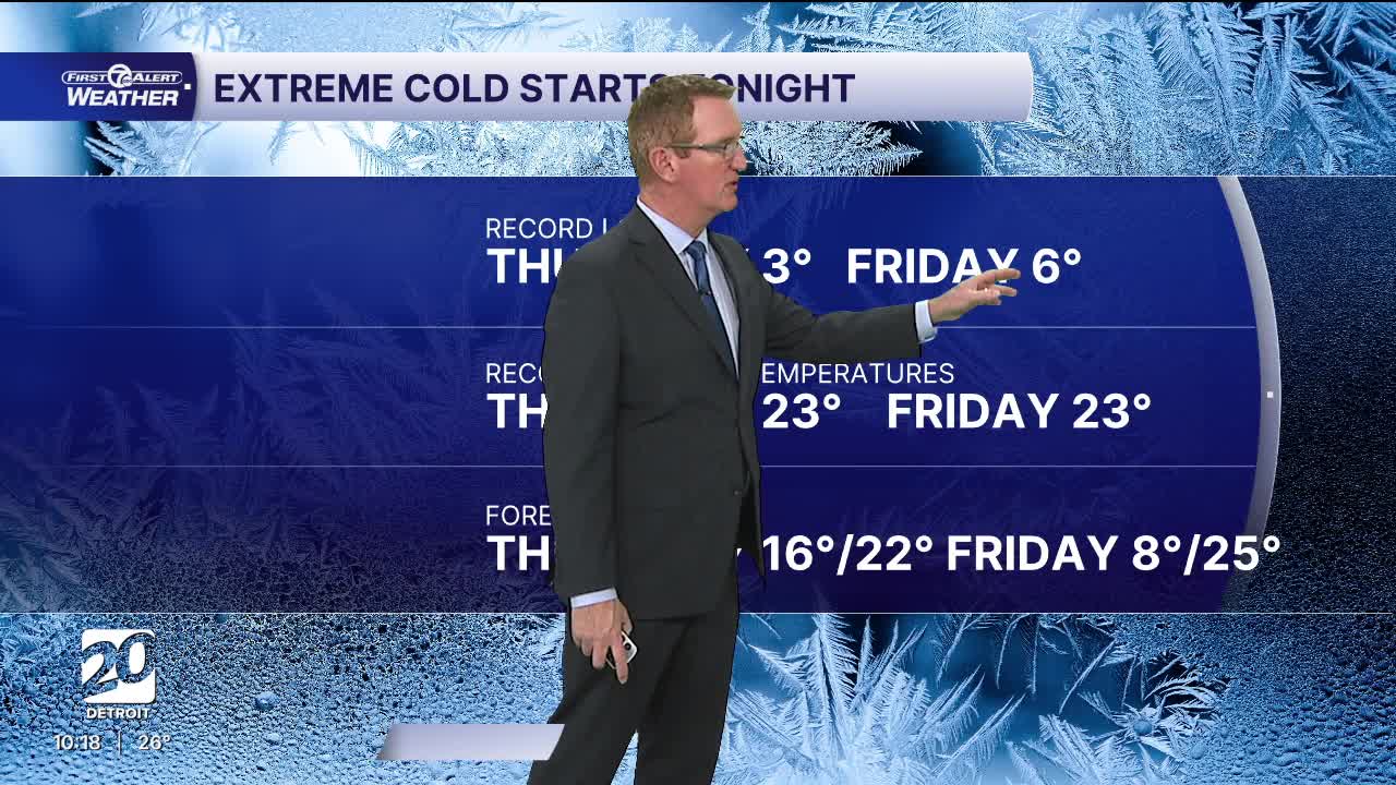
Thursday and Friday will be the coldest days of the week and of the season so far. Temperatures start in the low to mid teens Thursday morning and in the single digits to near 10° Friday morning. Highs climb into the low to mid 20s in the afternoon. Wind chills will be much colder too with both of the next two mornings starting with wind chills a few degrees either side of zero.
We add back a few degrees this weekend with highs close to 30°. Another small chance for light snow arrives Saturday.
Tonight: Clouds decrease with a few flurries possible. Lows in the mid teens. Wind chills a few degrees above zero in Detroit and a few degrees below zero to the west of Detroit. Winds: NW 10-20 mph.
Thursday: Partly to mostly sunny with wind chills just getting to double digits at their warmest. Highs in the low 20s. WNW at 10-20 mph.
Friday: Partly sunny with highs in the mid 20s and 25° in Detroit. Winds SW 5-10 mph will make it feel like the mid teens in the afternoon after wind chills start around 0°.
Connect with 7 First Alert Meteorologists on Facebook and X:
Facebook: Dave Rexroth , Hally Vogel, Marisa Woloszyn, Mike Taylor
