


A Winter Storm Warning continues for Monroe County until midnight.
A Winter Weather Advisory continues for Lenawee, Livingston, Macomb, Oakland, Washtenaw, and Wayne counties until midnight.
A Winter Weather Advisory continues for Sanilac County until 10 a.m. Monday. Lake effect snow from Lake Huron will bring localized snowfall around 1-3".
A Cold Weather Advisory has been issued for southeast Michigan from 7 p.m. Monday to 10 a.m. Tuesday. Wind chills will be -15° to -20°.
Snow showers continue through the early evening, but wrap up around 6 p.m. Here's a look at forecast totals for the storm. Observed totals will be updated later Sunday evening.
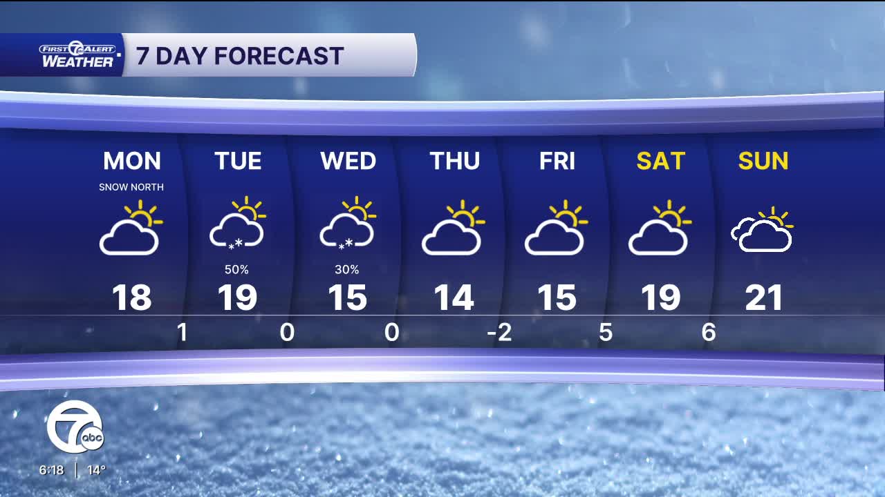
Lake effect snow showers will continue tonight and into Monday morning for Sanilac county. Localized amounts of 1-3" are expected. Everyone else can expect dry and mostly cloudy skies tonight. Temperatures will drop into the mid to upper single digits Monday morning. Skies will be mostly to partly cloudy during the day with highs in the upper teens.
A clipper system swings through Tuesday, bringing a light chance for snow across the area. A few more snow showers are possible Wednesday.
Cold temperatures stick around this week with highs in the mid to upper teens and lows near zero. Wind chills will be -5° to -20° most mornings.
Sunday: Snow. Heaviest in the afternoon. Highs in the mid to upper teens. Winds: NNE 10 G20 mph.
Tonight: Snow tapers off. Lows in the mid single digits. Wind chill: -5°. Winds: NW 10 mph.
Monday: Partly sunny. Lake effect snow showers north. Highs in the mid teens. Winds: NW 10-15 mph.
Connect with 7 First Alert Meteorologists on Facebook and X:
Facebook: Dave Rexroth , Hally Vogel, Marisa Woloszyn, Mike Taylor
