
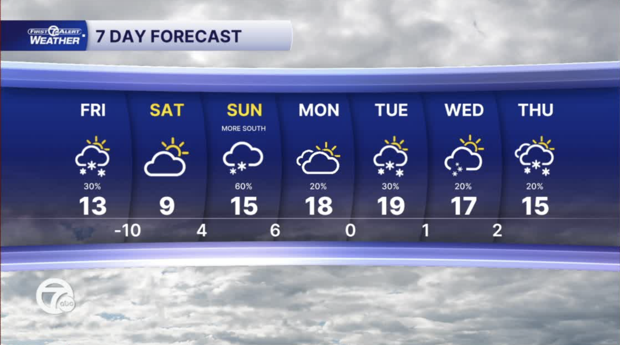


From Friday morning through this weekend, a significant shot of arctic air is expected to settle into Southeast Michigan. Highs on Friday and Saturday are forecast to be very cold in the single digits (around 7° and 9 °) with overnight lows dipping below zero — potentially well below zero Friday night and wind chills that could fall as cold as -20 ° early Saturday morning. It's the coldest air of the season so far and will stick around through the weekend.
Watch the full forecast in the video below
Snow chances will continue too. Snow is now expected Sunday and Sunday night. We will be on the northern edge of a very big storm to our south. The farther south you are, the more snow during this time. Areas south of Detroit could end up with 3"-5" by Monday morning with 1"-3" north of the city during the same time.
Friday: Partly sunny and cold! Highs in the single digits. Winds: WNW 15-25 mph. Wind chills as cold as 10-20 degrees below zero in the morning.
Saturday: We will start the day with temperatures of -5° to-10°. That is as cold as we have been in 7 years. Partly sunny with a few more clouds late. Highs in the single digits with wind chills of 10 to 20 below zero. Winds: E 5-10 mph.
Connect with 7 First Alert Meteorologists on Facebook and X:
Facebook: Dave Rexroth , Hally Vogel, Marisa Woloszyn, Mike Taylor
