

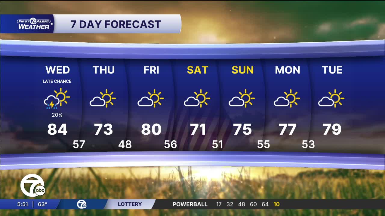


A warm and mainly dry day is ahead across Metro Detroit with temperatures climbing well above average this afternoon. Expect a mix of sunshine and increasing clouds through the day with highs reaching the lower 80s for most inland areas, including Detroit, Ann Arbor, Pontiac and Monroe. Cooler lakeshore communities near Port Huron and Port Sanilac stay closer to the upper 60s thanks to a breeze off Lake Huron. While most of the day stays dry, a very isolated shower or storm can’t be ruled out late this afternoon or evening. Winds stay fairly light out of the south around 5 mph.
Watch the full forecast in the video player below:
A comfortable start this morning with sunshine and temperatures in the mid 60s by 8 AM. Readings quickly warm through the 70s late morning before peaking near 80 degrees this afternoon. Clouds gradually increase during the second half of the day, but it remains warm and pleasant for most plans. A stray late-day shower is possible, though many neighborhoods stay dry.
Rain chances remain very low through the day and evening. Most locations stay dry with only spotty shower chances developing later this afternoon into tonight. The best opportunity for a brief shower or isolated storm arrives around the evening hours, but coverage stays limited and widespread rain is not expected.
Any isolated showers fade away this evening with skies gradually clearing overnight. It stays mild for late May with overnight lows mainly in the low-to-mid 50s, though downtown Detroit may hold closer to the upper 50s. Winds become light overnight with quieter conditions returning by daybreak.
A beautiful stretch of weather settles in for tomorrow with sunshine dominating from morning through evening. Temperatures start in the upper 50s early before warming into the upper 60s and low 70s during the afternoon. Comfortable humidity and light winds will make for a very pleasant late spring day across Southeast Michigan.
Warm temperatures continue into the weekend with highs around 80 Friday before a cooler but still pleasant Saturday in the low 70s. Sunshine and dry conditions return Sunday with temperatures rebounding into the mid 70s. Early next week trends even warmer again with highs pushing the upper 70s by Monday and near 80 degrees Tuesday under a mix of sun and clouds.
Today: Partly cloudy with a stray shower or storm possible. Highs will climb into the low 80s. Winds: NNE 5-10 mph
Tonight: A shower in possible early. Partly cloudy skies with lows near 57. Winds: NE 5-10 mph.
Thursday: Sunny skies with highs near 73. Winds: NNE 10-15 mph.
Friday: Sunshine continues with highs back in the low 80s.
Connect with 7 First Alert Meteorologists on Facebook and X:
Facebook: Dave Rexroth , Hally Vogel, Marisa Woloszyn, Mike Taylor
