


Temperatures hold pretty steady this evening and then rise overnight. Temperatures continue to climb to near 40° Tuesday. There could be a slick mix mostly north of I-69 with best chance in the thumb.
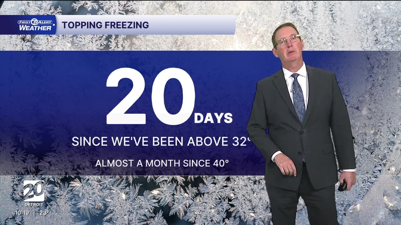
A system moves across northern Lake Superior Monday night into Tuesday, allowing us to fall into the warm section of the storm. But before we get to that point there is a chance for some freezing drizzle Monday night/very early Tuesday morning north of I-69, with minimal ice accumulation expected. This is not a concern for Metro Detroit. Tuesday will be mostly cloudy with highs near 40° around Detroit and south! Upper 30s will be common north of the city.
Colder air begins to push in Tuesday night, bringing temperatures back down and closer to average for the rest of the week, but warmer than we have been for the last two weeks!. Highs stay in the low to mid 30s through the weekend.
Check out the forecast:
Tonight: Freezing rain/sleet//snow mostly in the thumb. There will be a very slight chance of that north of M-59. It will be mostly cloudy in Metro Detroit. Lows in the low 20s early and then temps will slowly rise into sunrise. Winds: SSW 5-10 mph.
Tuesday: Mostly cloudy with an afternoon sprinkle possible. Highs around 40°. Winds: WSW 5-15 mph.
Wednesday: Partly sunny with highs in the low 30s including 33° in Detroit. Winds: NW 10-25 mph.
Connect with 7 First Alert Meteorologists on Facebook and X:
Facebook: Dave Rexroth , Hally Vogel, Marisa Woloszyn, Mike Taylor
