
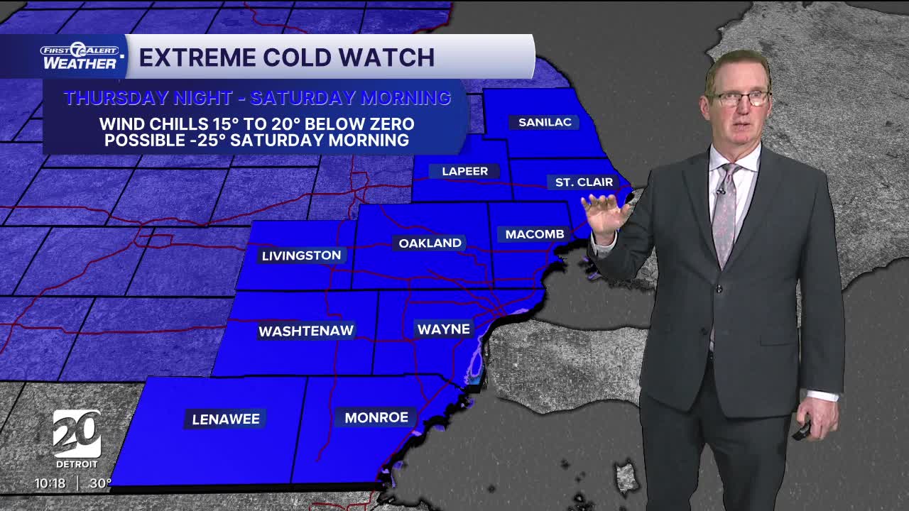


An Extreme Cold Watch goes into effect for all of Southeast Michigan from late Thursday night ( 1 AM Friday) through 10 AM Saturday. Dangerously cold wind chills are expected commonly of 15° to 20° below zero and as cold as 25° below is some spots Saturday morning.
Watch the full forecast below
Some snow showers could move through tonight with an inch or less of new snow by morning. Temps don't rise much Thursday and the extreme cold moves in Thursday night.
For Thursday night through the weekend, a significant shot of arctic air is expected to settle into Southeast Michigan. Highs on Friday and Saturday are forecast to be very cold in the single digits (around 8° or 9 °) with overnight lows dipping below zero — potentially well below zero Friday night and wind chills that could fall as cold as -25 ° early Saturday morning. It's the coldest air of the season so far and will stick around through the weekend.
Snow chances will continue too. Snow showers may spin up Saturday night and Sunday we may be on the northern edge of a very big storm to our south. The farther south you are, the better chances of snow during this time. Expect mostly cloudy, brutally cold conditions with occasional bursts of snow through the weekend before a slight moderation early next week.
Tonight: Scattered snow showers move through with up to 1" accumulation by morning. Lows will be around 20°. Winds: WSW 15-25 mph.
Thursday: Partly sunny with steady or falling temps in the low 20s. A few flurries are possible. Winds: W 15-25 mph.
Friday: Partly sunny and cold! Highs in the single digits. Winds: WNW 15-20 mph. Wind chills as cold as 15-20 degrees below zero in the morning.
Connect with 7 First Alert Meteorologists on Facebook and X:
Facebook: Dave Rexroth , Hally Vogel, Marisa Woloszyn, Mike Taylor
