
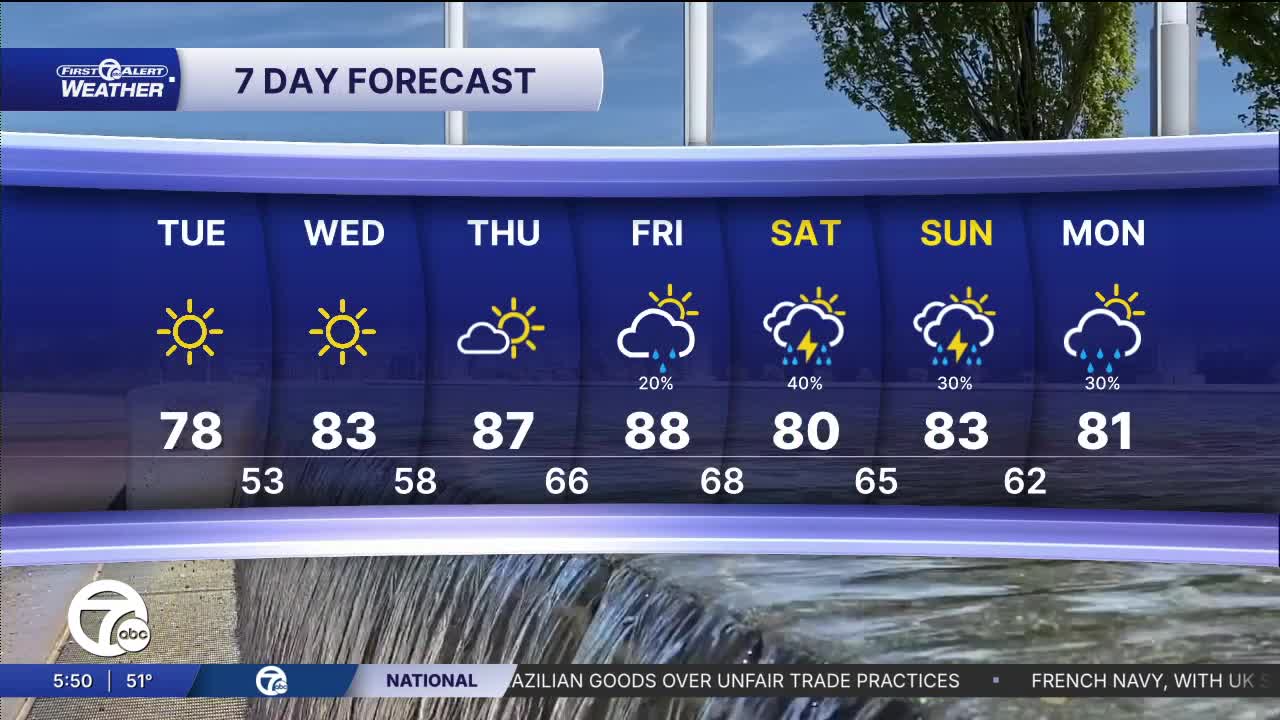


Another beautiful "early-summer" day is on tap across Southeast Michigan with abundant sunshine from start to finish. Afternoon temperatures will climb into the upper 70s for most communities, including around 78° in Detroit, with a light northeast breeze at 10 to 15 mph keeping conditions comfortable. Areas near Lake Huron will stay a bit cooler, holding in the lower 70s. Humidity remains low, making for an excellent day to get outside.
Watch the forecast below
Tonight, clear skies and light north-northeast winds will allow temperatures to cool quickly after sunset. Overnight lows will fall into the upper 40s and lower 50s across much of the region, including near 53° in Detroit. Some inland locations could dip into the mid-40s by daybreak, making for a refreshingly cool start to Wednesday morning.
Wednesday looks even warmer with wall-to-wall sunshine. Temperatures will rise from the lower 60s during the morning to around 80-81° by late afternoon. Winds remain light and humidity stays in check, providing another picture-perfect June day across Metro Detroit.
The warming trend continues late week as highs surge into the upper 80s Thursday and Friday. While most of Thursday appears dry, a few isolated showers or storms could develop Friday. A more active weather pattern is expected this weekend, with scattered thunderstorms possible Saturday and Sunday. Temperatures will ease back into the lower 80s by the weekend before settling near 80° early next week with additional chances for showers.
Today: Sunny with highs in the mid to upper 70s and 76° in Detroit. Winds: NE 5-10 mph.
Tonight: Clear skies with lows in the upper 40s and low 50s. Winds: NNE 5 MPH
Wednesday: Sunny with highs in the upper 70s and 80° in Detroit. Winds: SSE 5-10 mph.
Connect with 7 First Alert Meteorologists on Facebook and X:
Facebook: Dave Rexroth , Hally Vogel, Marisa Woloszyn, Mike Taylor
