
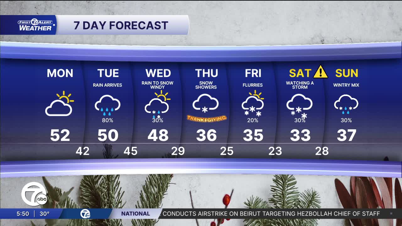


Mild temperatures continue Monday as clouds gradually increase throughout the day. Highs peak in the low 50s.
Check out the full forecast in the video below:
Rain moves in Tuesday with our next storm system. Showers will be widespread, but temperatures remain mild with highs in the low 50s. A few more rain showers move through Wednesday morning, before switching over to snow later in the day. Cold northwest winds 20-30 mph will bring the chance for lake effect snow Wednesday evening.
The colder air will drop highs into the mid to upper 30s for Thanksgiving Day. Some lake effect snow showers are possible, but most will stay to the north and west. Colder air continues through next weekend with more snow and rain likely. Overnight lows stay in the 20s and highs in the mid 30s.
Tonight: Partly cloudy. Lows in the upper 20s to near 30°. Winds: Light
Monday: Increasing clouds. Highs in the low 50s. Winds: SW 5-15 mph.
Tuesday: Rain showers. Highs in the low 50s. Winds: S 5-10 mph.
Connect with 7 First Alert Meteorologists on Facebook and X:
Facebook: Dave Rexroth , Hally Vogel, Marisa Woloszyn, Mike Taylor
