
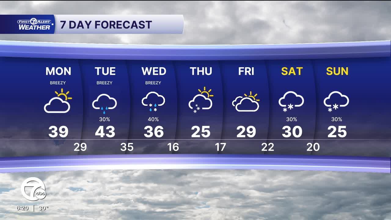


The workweek starts off quiet with partly sunny skies and highs in the upper 30s. Winds will be gusty out of the west-southwest 10-15 G25 mph.
Another storm moves in Tuesday and Wednesday. Showers will be rain Tuesday, with gusty southwest winds. Showers turn to snow Wednesday midday, with little accumulation across Metro Detroit. Temperatures will also drop from the low 40s Tuesday, to the mid 30s Wednesday with the storm.
Colder temperatures continue through the rest of the week and into next weekend with highs in the 20s and lows in the teens. More snow is likely next weekend.
Check out the forecast:
Tonight: Clouds increase. Lows in the mid 20s. Winds: SW 10-15 G25 mph.
Monday: Partly sunny and breezy. Highs in the upper 30s. Winds: WSW 10-15 G25 mph.
Tuesday: Mostly cloudy with increasing rain showers. Highs in the low to mid 40s. Winds: SW 10-15 G25 mph.
Connect with 7 First Alert Meteorologists on Facebook and X:
Facebook: Dave Rexroth , Hally Vogel, Marisa Woloszyn, Mike Taylor
