
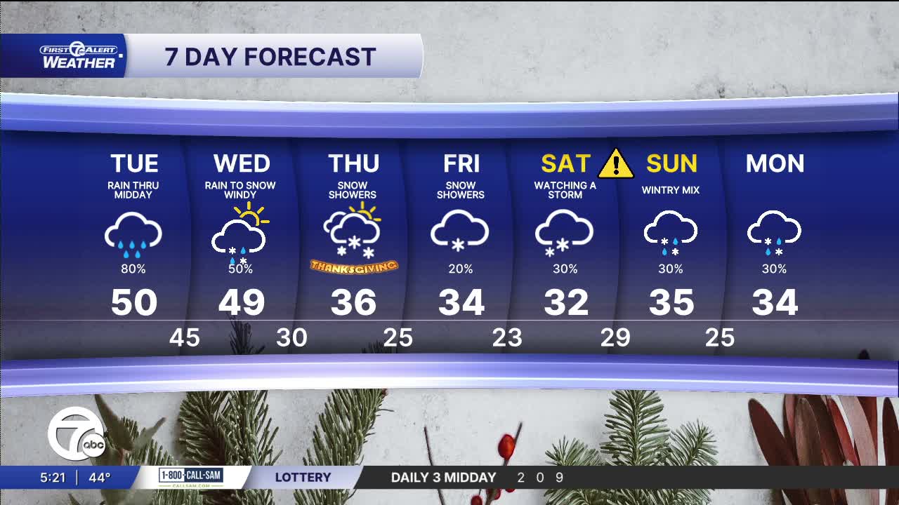


Some much-needed rain returns Tuesday morning and will continue through most of the day. Rainfall totals will be around 1/4". High temperatures hold near 50°.
A quick round of rain moves through Wednesday morning, but showers eventually mix with snow as the temps crash into the 30s in the afternoon. Winds will be strong with gusts near 40-45 mph Wednesday afternoon and evening.
See the full forecast in the video below
Then comes Thanksgiving Day, where highs continue to hold in the mid 30s with windy conditions and mostly cloudy skies — quite a change from earlier in the week. Snow showers are possible thanks to lake effect snow in the area, so beware of slick roads in spots. By Black Friday, the chill firmly settles in, with highs in the mid-30s and wind chills in the teens and 20s.
Looking ahead to the weekend, we're keeping an eye on a developing low‐pressure system that may impact the Metro Detroit area sometime this Saturday. Although details are still uncertain — including timing, track, and precipitation type — the key signals right now point toward a moderate chance of precipitation, possibly starting as rain, then transitioning toward snow or sleet as colder air arrives. Winds may also increase ahead of and behind the front, making for gusty conditions, lowering the wind chills.
Tonight: Cloudy skies with some sprinkles or a few light showers. Lows near 42°. Winds: Light
Tuesday: Cloudy with rain showers. Highs near 50°. Winds: Light
Wednesday: Rain early, snow chance increases. Temperatures fall from mid 40s to low 30s through the day. Strong Winds: WSW 25-40 mph.
Connect with 7 First Alert Meteorologists on Facebook and X:
Facebook: Dave Rexroth , Hally Vogel, Marisa Woloszyn, Mike Taylor
