


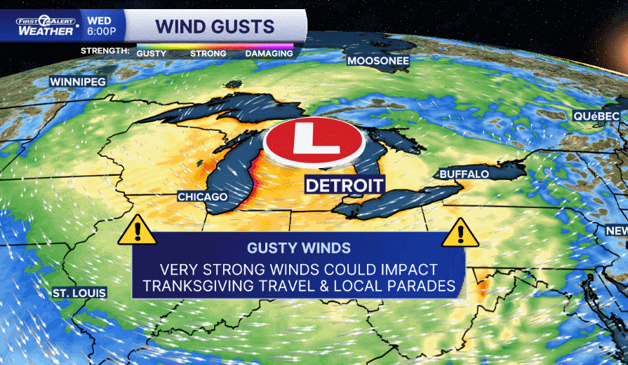
Gusty winds, lake effect snow, much colder temperatures, and chilling wind chills are all expected through the weekend.
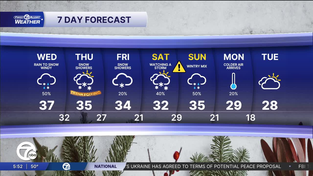
Another round of rain could move through Wednesday morning around a very strong cold front. Winds will also begin to pick up with gusts 20-30 mph. Winds continue to increase throughout the day with wind gusts 45 mph in the afternoon and evening. Lake effect snow showers ramp up in the afternoon, especially late. Slippery driving conditions are possible west or north of Detroit. Be prepared for snowy roads and poor visibility if you go to the west half of lower Michigan and north around Traverse City. Temperatures fall from the 40s to the mid 30s through the day.
Watch your full forecast in the video below
Windy weather continues for Thanksgiving. Wind gusts will be 30-40 mph throughout the day. Lake effect snow showers will continue, but heavier snow will stay to the west side of the state and up north. Temperatures will start in the mid 20s and peak in the mid 30s by the afternoon. Snow totals from late Wednesday through Thanksgiving Day will be 1"-2" around metro Detroit and 2" or a little more in the thumb and west of US-23.
Black Friday stays firmly on the chilly side with highs in the mid-30s, clouds mixing with limited sun, and the kind of brisk, wintry feel that makes you reach for gloves or a heavier coat.
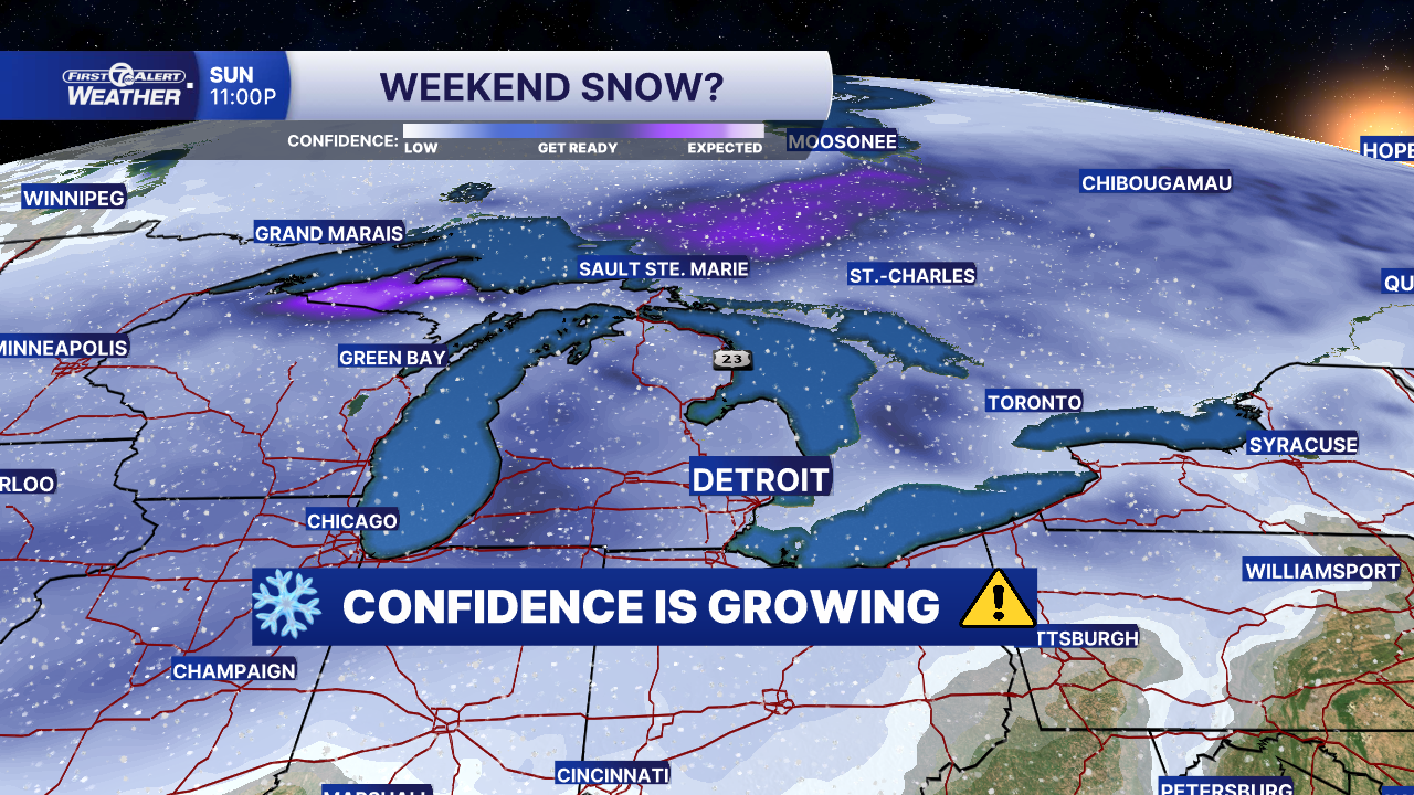
As we head into the weekend, the atmosphere is setting up for a another wintry change in Metro Detroit. Saturday looks chilly with increasing clouds and a chance of snow developing. Highs will hover in the mid to low 30s, and overnight lows dip towards the upper-20s. It will be cold enough for snow to stick to the roads. By Sunday, the odds are climbing for a more substantial impact with morning snow, which may transition to a wintry mix of snow, sleet and rain as temperatures rise above freezing later in the day. Winds will pick up, making the cold feel more biting, and visibility or travel could be impacted during the heavier bursts of snow. While it’s still “an early outlook” many details (precipitation track, amount & timing) remain uncertain.
Tonight: Cloudy skies, rain chance by morning. Lows in the mid 40s. Increasing Winds: SW 10-25 mph.
Wednesday: Rain chance in the morning, lake effect snow chance in the afternoon, especially late. Temperatures falling from the mid 40s to the mid 30s. Winds: WSW 25-35 mph, Gusts 45-50 mph.
Wind chills will be in the 20s by the late afternoon.
Thanksgiving Day: Much colder with a temps in the low to mid 30s and wind chills in the teens and low 20s. Snow showers are possible. Travel could be slippery. Winds: W 20-40 mph.
Connect with 7 First Alert Meteorologists on Facebook and X:
Facebook: Dave Rexroth , Hally Vogel, Marisa Woloszyn, Mike Taylor
