


Wind chills will hit single digits by morning.
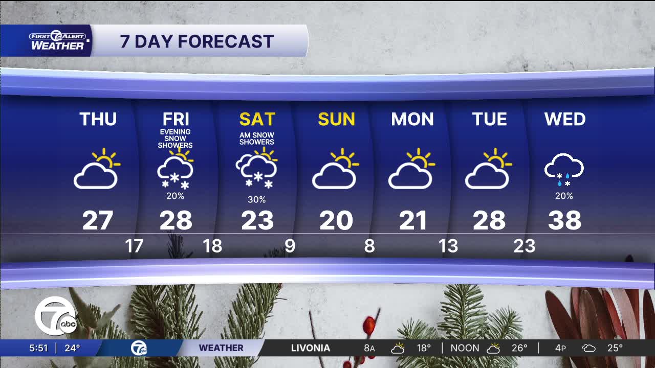
Thursday will be cold and windy with highs struggling to get out of the 20s. By Thursday night, temperatures drop into the teens, reinforcing that deep-winter pattern heading toward the weekend. Wind chills will be in the single digits Thursday morning and Friday morning.
See the full forecast in the video above
We’re watching another weak system bringing a chance of snow creeping back into the forecast for Metro Detroit by Friday evening, Friday night, and Saturday. On Friday, skies are expected to stay mostly cloudy and chilly, with a few scattered snow showers — not a heavy snow event, but enough to cause some slick roads across the area in the evening. Saturday snow showers could develop during the afternoon, with a chance for a light dusting or perhaps up to an inch — depending on where the showers line up. At the moment, the worst of this system may drift south of the Detroit area with lake-effect becoming the primary driver of accumulation.
Tonight: Partly cloudy skies with some flurries and falling temps back into the low 20s and teens. Wind chills will land in the single digits. Winds: NW 10-25 mph
Thursday: Partly sunny in the morning and then mostly cloudy in the afternoon with highs near 27°. Winds: W 10-20 mph
Friday: Partly sunny with a chance of snow showers in the evening. Highs will be in the mid to upper 20s with 28° in Detroit. Winds: WSW 5mph.
Connect with 7 First Alert Meteorologists on Facebook and X:
Facebook: Dave Rexroth , Hally Vogel, Marisa Woloszyn, Mike Taylor
