


A Freeze Warning has been issued for Lapeer, Macomb, Sanilac, and St. Clair counties until 8 a.m. Crops and plants sensitive to the cold could be killed.
A Frost Advisory has been issued for Lenawee, Livingston, Monroe, Oakland, Washtenaw, and Wayne Counties for the same time period. Plants sensitive to the cold could be damaged.
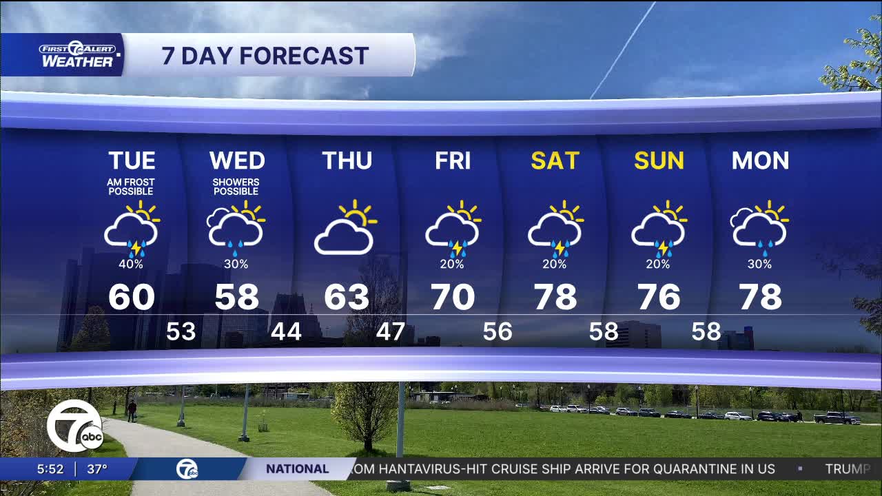
Watch the forecast below
Today starts with some sunshine, but clouds quickly increase. A few showers could move in by late in the day, maybe a bit sooner around I-69, with showers and storms possible after sunset. High temperatures remain cool for most and in the upper 50s, but warmer temperatures in the mid to upper 60s are likely in Washtenaw and Lenawee counties.
After the chilly stretch, temperatures begin a steadily warm by the weekend. Wednesday stays cool with scattered morning showers and highs near 60°, but sunshine returns Thursday with highs back into the low to mid 60s. By Friday and the weekend, Metro Detroit could be looking at the warmest weather in weeks with highs surging into the 70s and a few chances for pop-up showers or thunderstorms. Saturday currently looks like the warmest day, approaching the upper 70s.
Tuesday: Increasing clouds with rain chances mostly late in the day. Highs in the upper 50s to low 60s. Winds: S 10-20 mph.
Tonight: Not as cold with lows in the 50s. Winds: SSW 10-15 mph
Wednesday: Mostly cloudy with a few showers possible. Highs in the upper 50s. Winds: W 15-25 mph.
Connect with 7 First Alert Meteorologists on Facebook and X:
Facebook: Dave Rexroth , Hally Vogel, Marisa Woloszyn, Mike Taylor
