
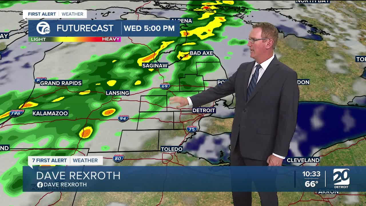


After many days with high pressure in control of our weather, changes are on the way for Wednesday. The high moves east and gives way to a storm system and trailing cold front from the northwest. After a dry start in the morning, clouds will increase through the afternoon ahead of the cold front. Showers and a thunderstorm chance arrive late afternoon or in the evening. Heavier rain could fall overnight. Severe weather is not expected, but localized half inch amounts are possible.
Cold air filters in behind the front dropping high temperatures into the mid to upper 60s Thursday. Another system quickly moves across the state Friday, bringing a slight chance for showers across Metro Detroit. High temperatures will be in the upper 60s to low 70s then. We are back to the 60s for highs this weekend.
Watch the full forecast below
Tonight: Mostly clear with lows in the mid to upper 50s. Winds: Light.
Wednesday: Increasing clouds in the afternoon. Rain and storm chances late. Highs near 80°. Winds: SW 10-20 mph.
Thursday: An early shower is possible, but much of the day will be partly sunny and dry with highs in the mid 60s. Winds: W 10 mph.
Connect with 7 First Alert Meteorologists on Facebook and X:
Facebook: Dave Rexroth , Hally Vogel, Marisa Woloszyn, Mike Taylor
