


A High Wind Warning has been issued for much of southeastern Michigan from 5:00 a.m. to 10:00 p.m. Friday. Gusts of 45 to 55 mph are likely.
Some areas may have a slick road north of M59 in the morning commute. A high wind warning will be in effect all day Friday for all of SE Michigan.
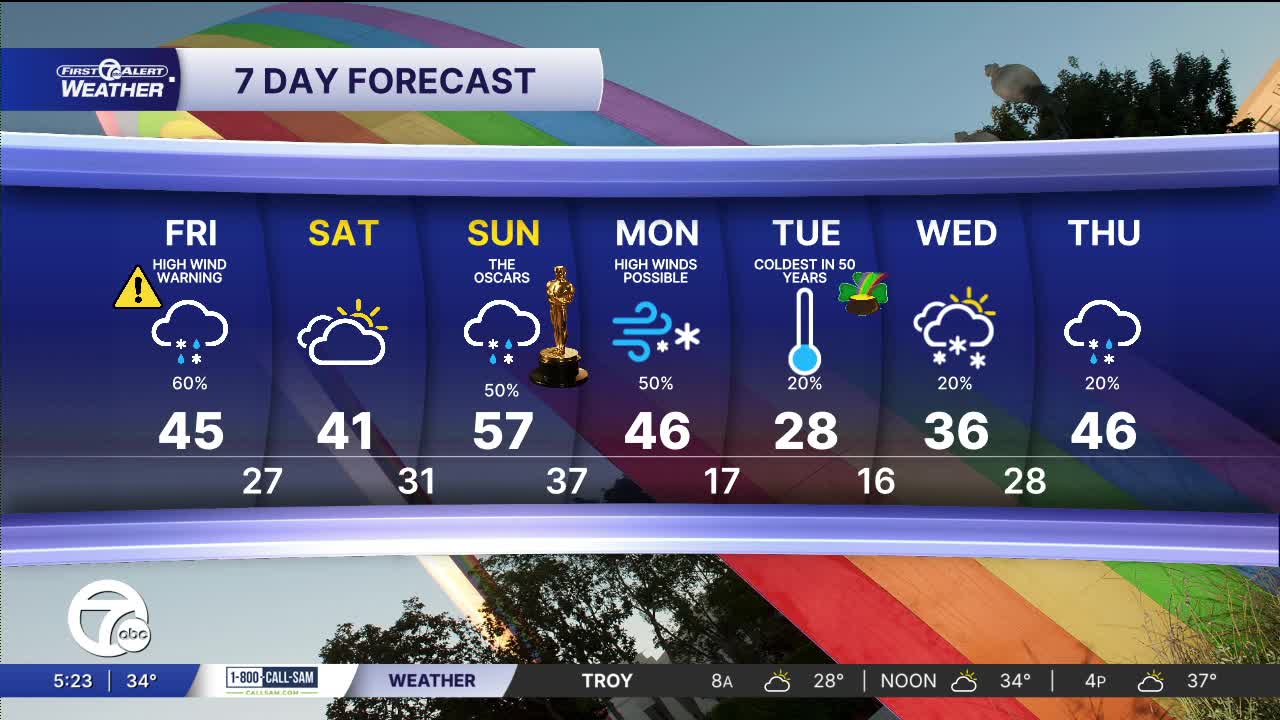
Watch the forecast below
A messy stretch of weather is expected from Friday morning to Friday evening across Metro Detroit. Snow will continue through Friday, with the best chance for accumulation north of Detroit, where 1 to 2 inches is possible around and north of areas like Pontiac to Lapeer and toward Port Huron. Closer to Detroit and south near Monroe and Ann Arbor, warmer air will mix rain with the snow, limiting totals to less than 1" in many spots.
A high wind warning will start at 5 AM Friday and runs through 10 pm. The strongest gust of 50-55 mph will start southwest of Detroit and then work toward the metro area and farther northeast.
Power outages are possible across all of southeast Michigan.
The weekend starts fairly quiet with partly to mostly cloudy skies Saturday, much less wind, and a high near 41°. Saturday night into Sunday morning there will likely be some more snow with some light accumulations. A big warm-up arrives Sunday with rain possible in the afternoon and temperatures jumping to about 57°. The wind will be strong again Sunday night and Monday. Much colder temperatures move in Monday night with lows near 17° by Tuesday morning.
Friday: A high wind warning with gusts of 50 to 55 mph and a few gusts possible to 60 mph. A mix of rain and snow showers is likely. Highs will be in the low to mid 40s. Winds: W 25-50 mph.
Saturday: Mostly cloudy with highs near 40°. Winds: NW 5-15 mph.
Connect with 7 First Alert Meteorologists on Facebook and X:
Facebook: Dave Rexroth , Hally Vogel, Marisa Woloszyn, Mike Taylor
