
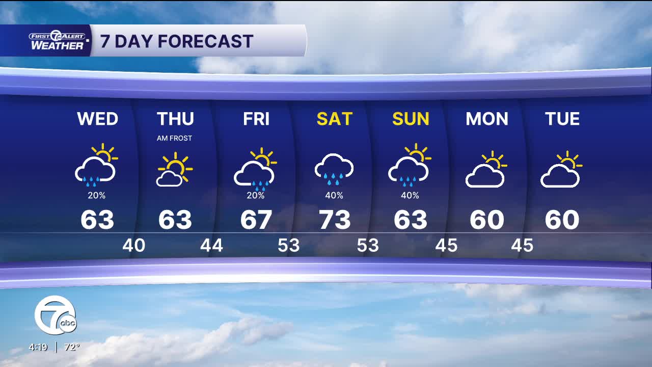


Some mid-level moisture will bring a chance for a few light showers early Wednesday morning, before sunshine returns for the afternoon. Highs will be cooler and in the low 60s.
Clear skies Wednesday night will allow temperatures will fall into the mid 30s, to near 40°, by Thursday morning. Areas of frost are likely, before sunshine and 60s return for the afternoon.
A shift to a more active weather pattern comes this weekend as rain chances increase across southeast Michigan. A few showers are possible Friday, but more widespread rain is likely Saturday and Sunday.
Watch the full forecast
Tonight: Partly cloudy with spotty showers late. Lows in the upper 40s. Winds: NE 5-10 mph.
Wednesday: Spotty showers early, then clearing skies. Highs in the low 60s. Winds: N 5-10 mph.
Thursday: Morning frost. Mostly sunny with highs in the low 60s. Winds: NE 5 mph.
Connect with 7 First Alert Meteorologists on Facebook and X:
Facebook: Dave Rexroth , Hally Vogel, Marisa Woloszyn, Mike Taylor
