
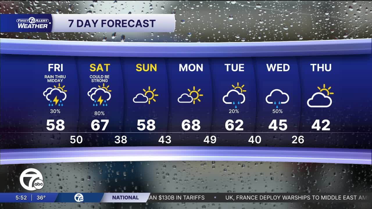


The fog could be quite dense into early Friday. Friday late there could be a shower or storm The best chance is after 3 PM. Rain is likely again Saturday morning.
Watch the forecast below
The fog could be quite dense into early Friday. Friday late there could be a shower or storm. The best chance is after 3 PM. Rain is likely again Friday night, and Saturday morning. The highest chance of thunder will be Friday night though Saturday morning. Some storms could be heavy.
The weekend will finish much nicer on Sunday with some sun and highs in the upper 50s. Next week will be warm through Wednesday with highs in the mid 50s to the upper 60s.
Tonight: Patchy fog is likely with some dense fog. Along with the fog there may be drizzle. Lows will be in the mid 30s. Winds: Light.
Friday: Mostly cloudy with a slight rain or storm chance, mostly late after 3 PM. Highs will be in the low to mid 50s around Metro Detroit. Near the Ohio border you have a shot at 60° and some areas in the northeast region will get stuck in the upper 40s. Winds: SE 5-10 mph.
Saturday: It will be mostly cloudy and warmer with highs well into the 60s with 67° in Detroit. There should be showers around in the morning with a storm chance too. A few storms could be heavy. Winds: SSW 20-35 mph.
Connect with 7 First Alert Meteorologists on Facebook and X:
Facebook: Dave Rexroth , Hally Vogel, Marisa Woloszyn, Mike Taylor
