


A Flood Watch is in effect for all of Southeast Michigan through 2 a.m. Friday. Several rounds of showers and thunderstorms could bring another 1-2 inches of rainfall widespread. Flooding of low lying, urban, or poor drainage areas are possible. Area rivers, creeks, and streams are expected to rise.
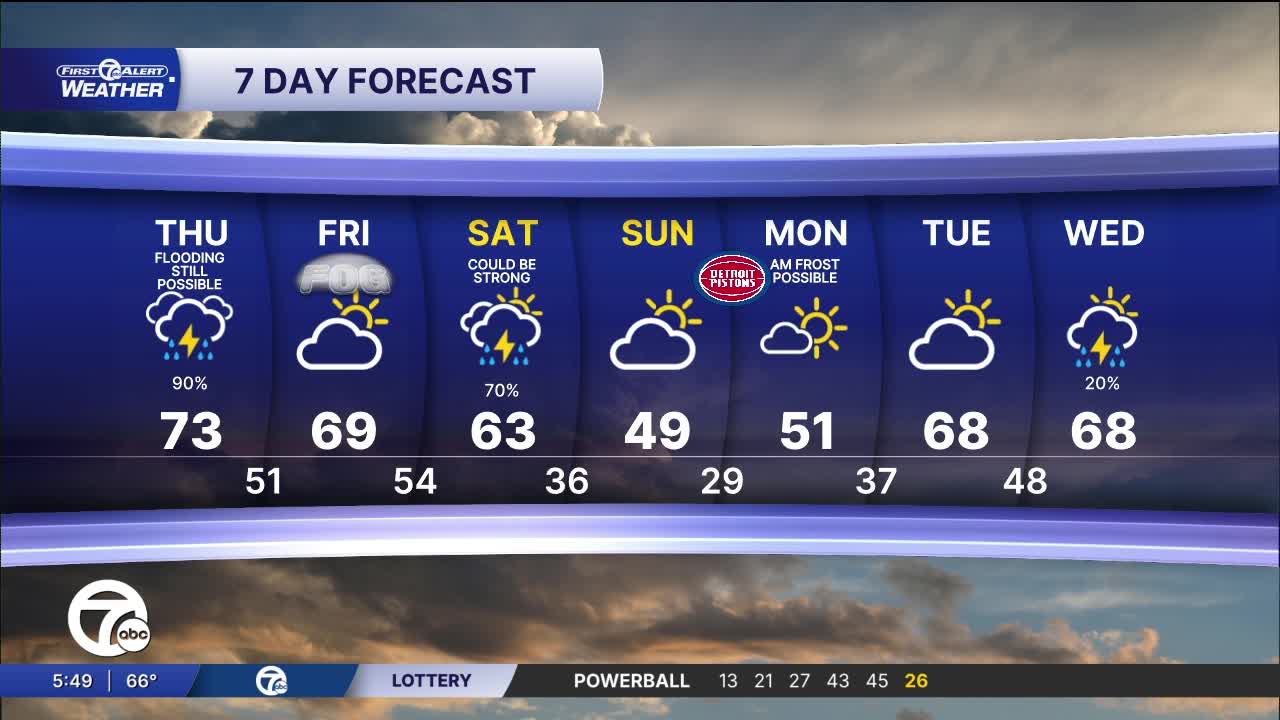
Thursday stays warm and stormy, at times, with highs in the low to mid 70s. Quiet and dry weather moves in for Friday. Skies will be partly sunny with highs near 70°. After another rainy day with the chance of more storms Saturday, we will finally get a break in the unsettled pattern. Temps drop and the air dries out early next week.
See the full forecast in the video below
Thursday stays warm and stormy, at times, with highs in the low to mid 70s. Quiet and dry weather moves in for Friday. Skies will be partly sunny with highs near 70°. After another rainy day with the chance of more storms Saturday, we will finally get a break in the unsettled pattern. Temps drop and the air dries out early next week.
Tonight: Chance for a few storms, possibly severe. Lows in the low 60s. Winds: SSW 10-15 mph.
Thursday: Showers and storms are still likely. Highs in the low to mid 70s. Winds: SW 10-20 mph.
Friday: Partly sunny with highs in the mid to upper 60s. Winds: S 5-10 mph.
Connect with 7 First Alert Meteorologists on Facebook and X:
Facebook: Dave Rexroth , Hally Vogel, Marisa Woloszyn, Mike Taylor
