
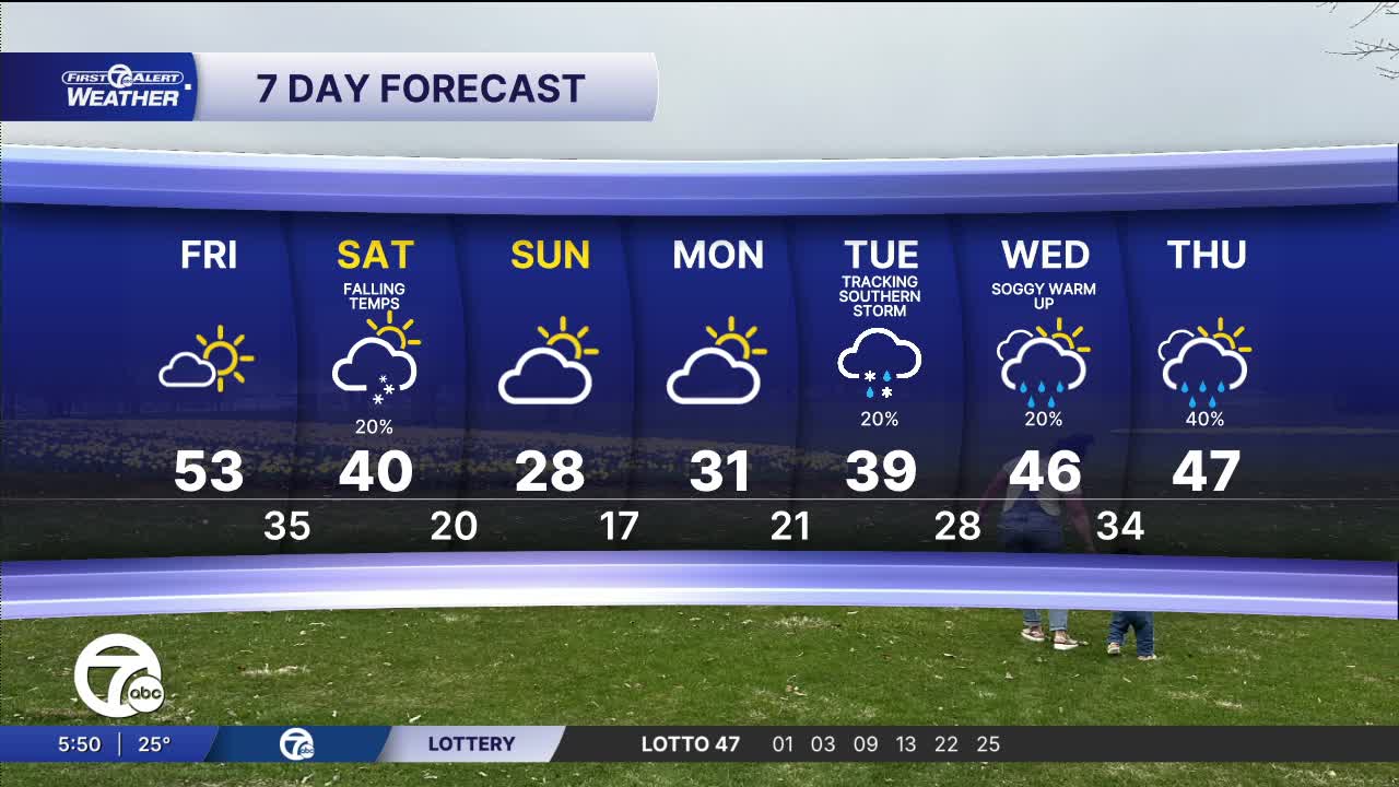


It will be mostly sunny Friday with high temperatures in the upper 40s on the NE side of SE Michigan and in the low 50s from Detroit and to the west. It will become breezy in the afternoon.
Watch the full forecast below
It will be a milder finish to the week on Friday with mostly sunny skies and highs climbing into the upper 40s in the NE part of town and in the low 50s around Detroit and areas to the SW. It’ll be breezy at times with gusty southwest winds adding a bit of a spring preview.
A milder start to the weekend gives way to another quick return to Winter. Saturday brings an increase in clouds with highs returning into the upper 30s to near 40 before winds shift and increase late in the day. A system moves in Saturday evening and night with some snow as colder air returns, bringing the chance for light accumulations Saturday night and a few possible slick spots for the morning. Sunday turns colder and breezy with highs in the upper 20s to near 30 degrees and a few leftover flurries before quieter but chilly conditions settle in to wrap up the weekend.
Tonight: Clear to partly cloudy with lows in the mid 20s. Winds: SSW 5 mph.
Friday: Mostly sunny and warm with a high around 50°. Detroit and areas southwest of Detroit have the best chance of being a little warmer than 50°. Winds: SW 15-30 mph.
Saturday: Increasing clouds with a slight snow chance late in the day. Highs will be around 40° early afternoon and then temps will drop slowly. Winds: N 10 mph.
Connect with 7 First Alert Meteorologists on Facebook and X:
Facebook: Dave Rexroth , Hally Vogel, Marisa Woloszyn, Mike Taylor
