WeatherForecastTodays Forecast

Metro Detroit Weather: Quiet today, tracking a wintry system for Tuesday

Metro Detroit Weather: Quiet today, tracking a wintry system for Tuesday
Posted
and last updated

Planning your day? Check out the Day Planner Plus with Mike Taylor

Day Planner Plus: Monday, November 17

This week in Metro Detroit starts off chilly and somewhat unsettled before gradually turning milder toward the weekend.

Watch the full forecast below
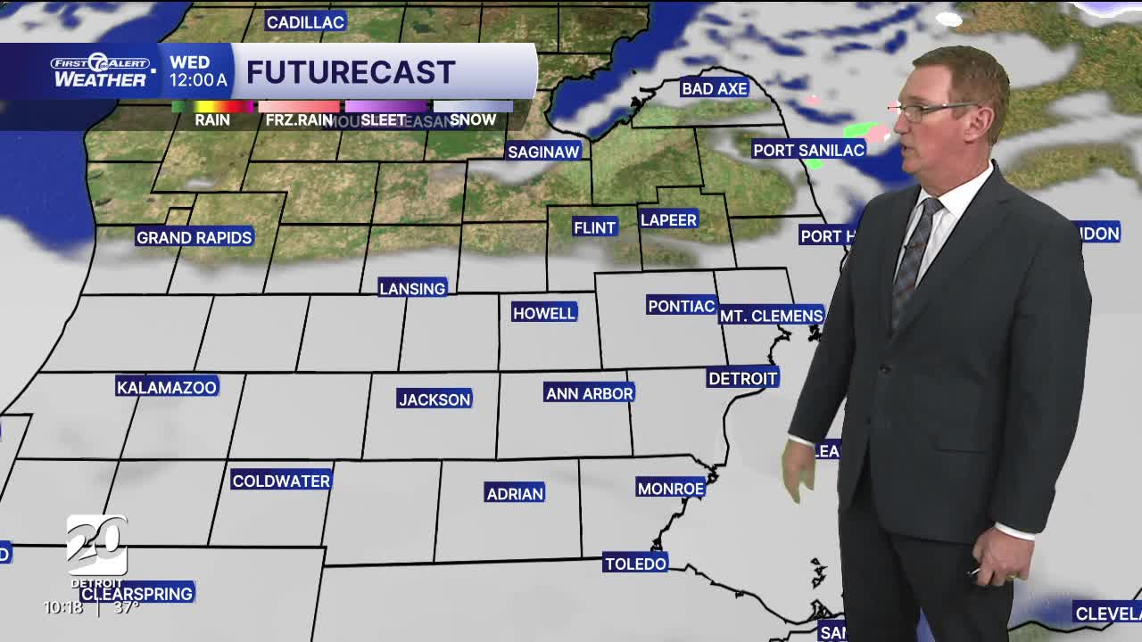
Metro Detroit Weather: Quiet today, tracking a wintry system for Tuesday

Today stays partly sunny but still on the cool side with highs near 44°.
A more noticeable shift happens Tuesday as a compact mid-level low sweeps across the northern Ohio Valley. This disturbance strengthens a frontal boundary aloft, creating enough lift for periods of light rain and snow throughout the day. Allow for extra time during the morning commute in case there are slick spots across the area in the morning.

Temperatures will hover in the upper-30s to low-40s, so any wintry mix should be minor with little to no accumulation. By Wednesday, the influence of that system fades, and the area sees a mix of clouds and sun with temperatures nudging back towards the mid-40s as high pressure slowly builds in. Thursday keeps a blanket of low clouds around, but the broader pattern begins shifting, drawing in milder air from the southwest. This warming trend peaks on Friday with cloudy skies, a possible touch of rain, and highs climbing into the low-50s. This will be the warmest point of the week. Saturday remains mild for November, with highs near 47° and plenty of low clouds lingering.

What’s driving all these changes is the dance between air masses, passing disturbances, and shifting wind patterns around the Great Lakes. Early in the week, Detroit sits under a colder air mass that moderates slowly. Tuesday’s rain/snow mix comes from the compact low moving through the region, which intensifies a mid-level front and provides just enough lift for precipitation. As the week progresses, the jet stream's position relative to Detroit supports a milder southwest flow, allowing temperatures to rebound into the 50s by Friday and keeping us close to that temperature over the weekend.

Today: Mostly sunny. Highs in the low to mid 40s. Winds: WNW 10-25 mph.

Tonight: Clouds build as a system approaches with lows near 27. Winds: Light

Tuesday: Wintry mix, with freezing rain possible. Highs in the upper 30s, near 40°. Winds: Light

Connect with 7 First Alert Meteorologists on Facebook and X:

Facebook: Dave Rexroth , Hally Vogel, Marisa Woloszyn, Mike Taylor

X: Dave Rexroth , Hally Vogel, Marisa Woloszyn, Mike Taylor