


Dense fog overnight should be widespread. The rain chance lasts from time to time through Friday. There could be a few flakes Friday as well. Temps will slowly cool through the weekend.
Watch the forecast below
A milder but gray Thursday is on tap across Metro Detroit with highs climbing into the mid 40s under mostly cloudy skies. Winds turn breezy out of the southeast. A few showers are possible and thunder is an option too. Moisture increases late with rain likely developing Thursday night and continuing into early Friday. That means a damp start to Friday across the area with rain during the morning commute but temperatures briefly stay in the low 40s. As the system pulls away, winds shift and cooler air filters in, allowing readings to gradually fall back into the 30s through the afternoon and evening with lingering clouds as winter makes a comeback.
A return to more typical late-February weather this weekend gets started on Saturday with mostly cloudy skies and highs only in the mid 30s. After Friday’s rain and mild air exit, cooler air settles in and temperatures fall off quickly into the low 20s Saturday night with a quiet but colder feel heading into Sunday. Therefore, a chilly end to the weekend with cloudy skies and highs near the low 30s, Sunday. A weak system passing through the Great Lakes may bring a few periods of light snow or flurries, especially later in the day, but any accumulation looks minor at this time.
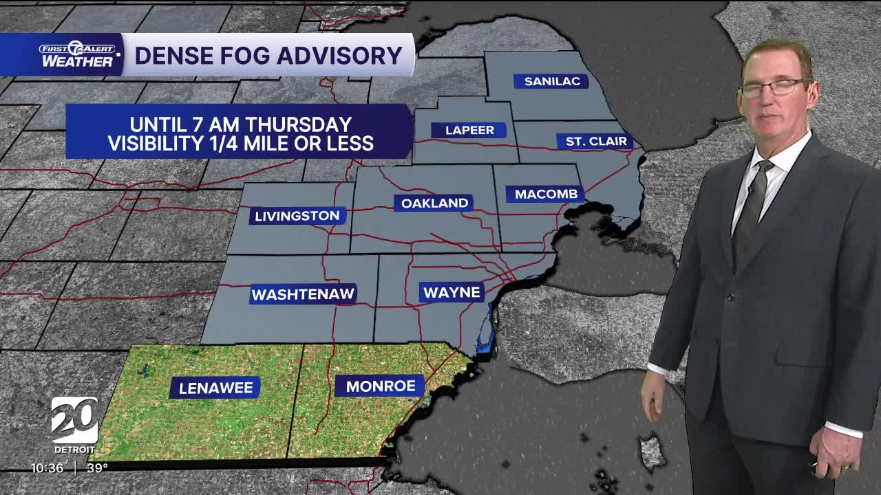
Tonight: Dense fog advisory until 7 AM all areas except Lenawee and Monroe counties.
Clouds and fog should increase again with a slight rain chance. Lows near 34. Winds: SE 5 mph
Thursday: Foggy start with mostly cloudy skies. A shower and maybe even thunder is possible. There could be strong storms to our south in Indiana and western Ohio. Highs will reach the mid 40s. Winds: SE 10 mph
Friday: Mostly cloudy with a chance of mixed light rain and snow showers. Highs in the mid to upper 40s and dropping late. Winds: SW 10-25 mph.
Connect with 7 First Alert Meteorologists on Facebook and X:
Facebook: Dave Rexroth , Hally Vogel, Marisa Woloszyn, Mike Taylor
