


A Winter Weather Advisory is in effect for St. Clair and Macomb counties until 4 a.m. Monday. Lake effect snow showers will lead to reduced visibility and slippery driving conditions.
A rain/snow mix will gradually end Sunday evening, as the storm system moves into the Northeast. Northerly winds will bring lake effect snow bands off of Lake Huron Sunday night into early Monday morning. Winds will shift to the northwest, shutting down lake effect snow showers from Lake Huron for our area. There is still a chance we may get a band to stretch all the way across the state from Lake Michigan, but the chance remains low. Temperatures will start in the mid 20s and climb into the low to mid 30s by the afternoon. Gusty northwest winds 15-25 mph will bring winds chills into the teens Monday morning and mid 20s in the afternoon.
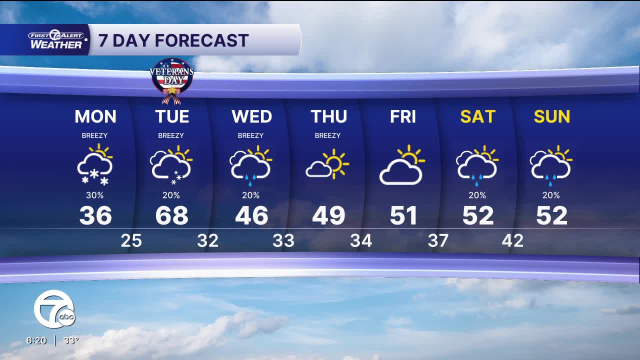
Check out the full forecast:
We'll keep a slight chance for a snow showers Tuesday, with highs in the mid upper 30s. Gusty winds out of the west-southwest 15-35 mph will make it feel like the teens in the morning and mid 20s in the afternoon.
A few more rain showers are possible Wednesday, before drier and warmer weather returns for the end of the week.
Tonight: Lake effect snow showers, cold. Lows in the mid 20s, with wind chills in the teens. Winds: N 10-20 mph.
Monday: Lake effect snow showers possible, otherwise partly sunny. Highs in the low to mid 30s, with wind chills in the mid 20s. Winds: NNW 15-25 mph.
Tuesday: Mostly cloudy with a slight chance for snow. Highs in the mid to upper 30s, with wind chills in the upper 20s. Winds: WSW 15-30 mph.
Connect with 7 First Alert Meteorologists on Facebook and X:
Facebook: Dave Rexroth , Hally Vogel, Marisa Woloszyn, Mike Taylor
