


A Flood Watch has been issued for all of Southeast Michigan through 2 a.m. Friday. Several rounds of showers and thunderstorms could bring 1-2 inches of rainfall widespread with 3-4 inches possible in some areas. Flooding of low lying, urban, or poor drainage areas are possible. Area rivers, creeks, and streams are expected to rise.
Steady rain will continue into the early morning hours of Wednesday. Flooding will become more of a concern for the morning drive.
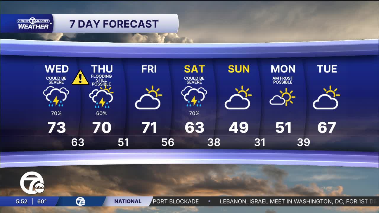
Rain showers and a storm chance continue Wednesday with temperatures in the mid-60s. Temperatures climb into the low 70s by the afternoon with scattered showers redeveloping. By the mid to late afternoon, a few thunderstorms are likely, a few of which could be strong to severe.
Thursday stays warm and somewhat stormy with highs in the mid 70s. Quiet weather moves in for Friday. Skies will be partly sunny with highs in the low 70s.
Watch the forecast below
Tonight: The severe threats of wind, hail, and a tornado overnight is over. Steady rain will continue to complicate possible flooding. Lows in the low to mid 60s. Winds: SSW 10-20 mph.
Wednesday: More storms are likely and a few could be severe. More rain will increase the flood chance. Highs in the low to mid 70s. Winds: SW 10-20 mph.
Thursday: Showers and storms are still likely. Highs in the low to mid 70s. Winds: SSW 10-20 mph.
Connect with 7 First Alert Meteorologists on Facebook and X:
Facebook: Dave Rexroth , Hally Vogel, Marisa Woloszyn, Mike Taylor
