
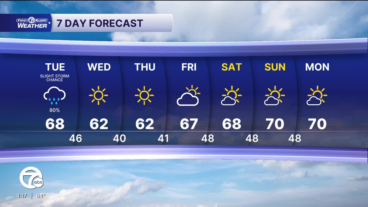


Rain returns Monday night, with a few thunderstorms possible. The wet weather is ahead of a cold front that will move through midday Tuesday. Showers will continue Tuesday until the front passes, at which rain will end across Southeast Michigan. Widespread rainfall will be 1/4-1/2", but higher totals are possible in thunderstorms. Temperatures will fall into the mid 60s Monday night and only climb into the mid to upper 60s Tuesday.
High pressure builds back in Wednesday, bringing sunny skies through the rest of the week. Temperatures will be much cooler with highs near 60° to the mid 60s and morning lows in the mid 30s to near 40°.
Watch the full forecast
Tonight: Rain and possible thunderstorms. Lows in the mid 60s. Winds: S 5-10 mph.
Tuesday: Storms possible early. Showers. Highs in the mid to upper 60s. Winds: SW/NW 5-10 mph.
Wednesday: Sunny. Highs in the upper 50s to low 60s. Winds: N 10 mph.
Connect with 7 First Alert Meteorologists on Facebook and X:
Facebook: Dave Rexroth , Hally Vogel, Marisa Woloszyn, Mike Taylor
