


Temps are much colder with a chilly breeze leading into the early morning hours Friday.
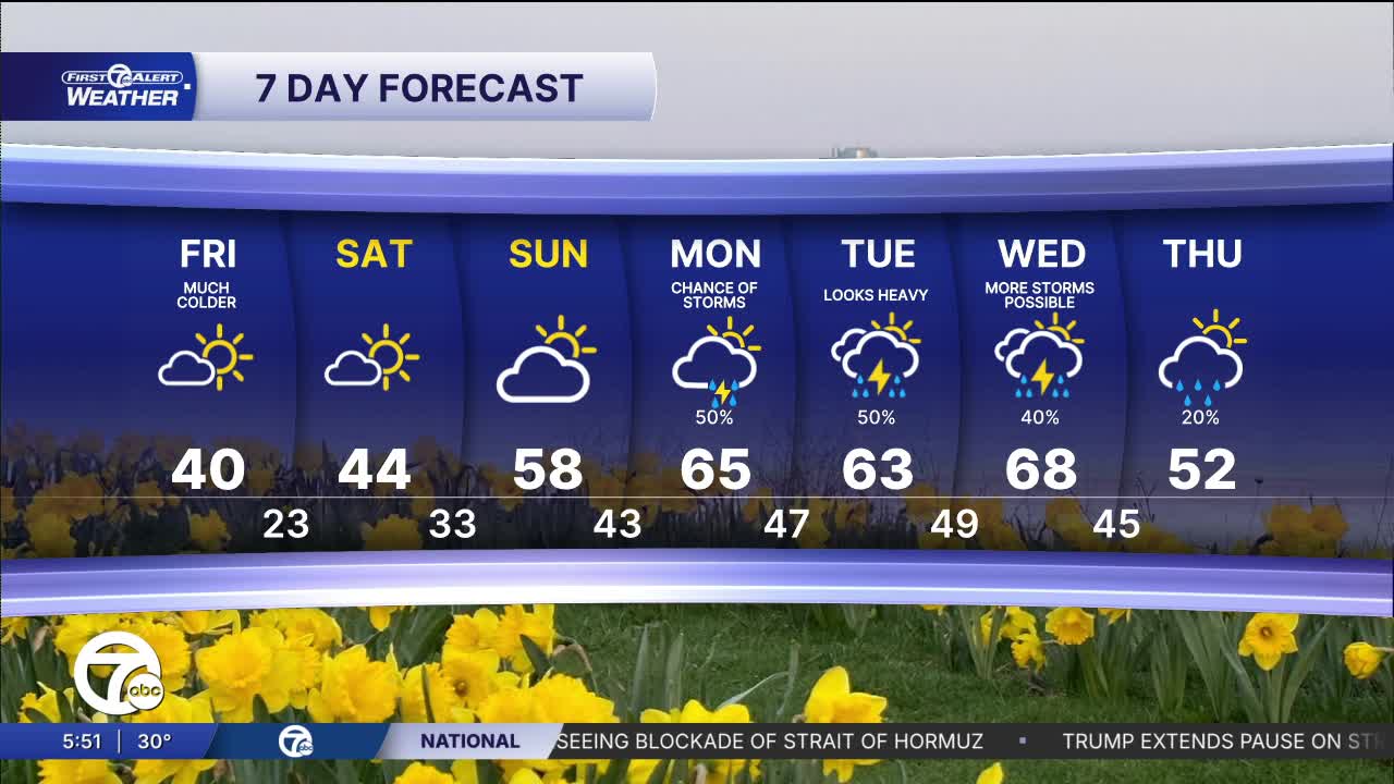
Friday will be a bit of a shock with highs struggling to reach 40°. Many areas won't make even that. This comes after hitting the 60s and 70s for highs today. We will slowly warm through the weekend with high temps in the mid to upper 50s again by Sunday. The weekend should also be dry with decent sunshine.
Watch the forecast below
Tonight: The rain ends late. Then it will become partly cloudy with falling temps back to the low 20s and 30s. Winds: NNE 15-20 mph
Friday: Much cooler with a chilly breeze. There will be some sun, but it won't help too much. Highs will be around 40° in Detroit and a little cooler north of the city. Winds: NNE 10-20 mph.
Saturday: Mostly sunny with highs in the mid 40s. W 5-15 mph.
Connect with 7 First Alert Meteorologists on Facebook and X:
Facebook: Dave Rexroth , Hally Vogel, Marisa Woloszyn, Mike Taylor
