


A Winter Storm Watch is in effect for Sanilac County from Wednesday afternoon through Thursday morning, where up to 5 inches of snow is possible.
Temps drop all day Wednesday and wind chills drop into the single digits by evening. It will be a real winter feel for several days to come! There will be many snow chances over the next several days.
Temperatures drop tonight with morning temperatures in the low to mid 30s by sunrise. Winds shift to the northwest behind two cold fronts move through Wednesday morning. Temperatures fall throughout the day, into the low 20s by the early evening and into the teens by Wednesday night. Wind chills will drop to the single digits by Wednesday evening and to the single digits below zero by Thursday morning.
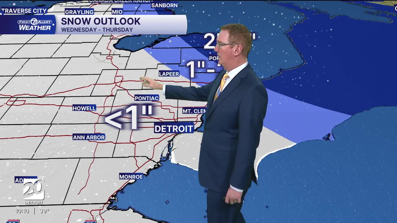
Snow showers will be on and off throughout the day Wednesday. Accumulation will be up to 1" for most of us in southeast MI. Higher amounts of 1"- 2" are possible near Port Huron and St. Clair County. 2"- 5" is possible Wednesday through Thursday along the shoreline in Sanilac County.
By Thursday, much of the colder air is here. Expect brighter skies with highs near 20° along with brisk northwest winds. Some lake effect snow showers will linger near Lake Huron, but most of us will stay dry. Wind chills will range from just below zero in the morning to barely double digits in the afternoon.
Watch the full forecast below
This Evening: Clouds increase with some rain north of M-59. Temps dropping back into the 30s. Winds: SW 15-25 mph,
Tonight: Mostly cloudy. A few rain and snow showers are possible with the passing of the first cold front. Lows will be in the low to mid 30s by 7AM. Winds: WSW 10-20 mph.
Wednesday: Snow showers expected with most in the morning with the passing of the second cold front. Temperatures drop all day to the low to mid 20s by the early evening and evening wind chills in the single digits. Winds: NW 15-30 mph.
Thursday: Partly sunny and very cold with highs struggling to get to 20°. Wind chills will start just below zero and finish barely in the double digits. Winds: NW 10-15 mph.
Connect with 7 First Alert Meteorologists on Facebook and X:
Facebook: Dave Rexroth , Hally Vogel, Marisa Woloszyn, Mike Taylor
