


Storm chances overnight tonight will be mostly from around 2AM to 6AM. An isolated storm could be severe with large hail or damaging wind. It will be a busy week with rain and storm chances. With an exception on Wednesday, it will be a mild to warm week with most highs in the 60s and 70s.
There could be an isolated severe storm late overnight with hail being the main threat. On Tuesday the severe storm chance will increase. There could be a round in the afternoon and again in the evening. More storms are possible Tuesday night, Thursday through Friday, and again on Saturday. Keep your umbrella handy and keep an eye on the sky. Of course, we are always here to keep you updated!
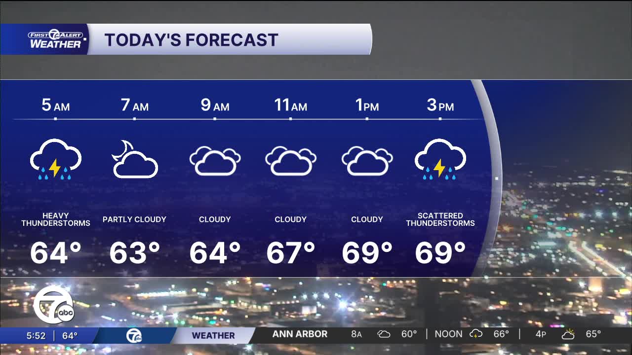
Watch the forecast below
Temperatures drop Wednesday as cooler air filters in. Temperatures peak in the mid 40s in the afternoon. Rain is expected and a few storms are possible, but there shouldn't be any severe weather.
Steadier rain moves in Thursday, with a chance for a wintry mix in the tip of the thumb and the Saginaw Valley. High temperatures climb into the mid 60s. Rain continues into Thursday night, before wrapping up Friday morning. Rain showers could impact tailgating for the Tigers' home opener, but right now look like they should be wrapped up by the first pitch. Highs climb into the mid 60s Friday.
Tonight: Scattered showers and storms are possible from around 2-6 AM. An isolated severe storm is possible with large hail being the greatest threat. Lows near 60° with winds: SW 10-20 mph and a few gusts to 25 mph possible.
Tuesday: Rain and storms possible in the early morning, early to mid afternoon, then again in the evening. The severe threat is higher than Monday night and will include all threats. Highs will reach the low 70s. Winds: SW 15-25 mph.
Wednesday: Mostly cloudy with rain expected. There should more rain south than north. Highs in the mid 40s with a NE wind at 10-15 mph.
Connect with 7 First Alert Meteorologists on Facebook and X:
Facebook: Dave Rexroth , Hally Vogel, Marisa Woloszyn, Mike Taylor
