


We’ll start the day on a damp and chilly note across Metro Detroit. Early morning showers are likely through about mid-morning, with temperatures sitting in the low to mid 40s. It’s not a washout, but you’ll definitely want the umbrella heading out the door. By late morning, the rain tapers off and we’re left with a mostly cloudy sky with peeks of sunshine.
Through the afternoon, clouds hang tough but temperatures do gradually recover. Most spots climb into the upper 40s to around 50 degrees, with a few locations briefly touching the low 50s. Overall, it’s a quiet but gray day, with just a spotty shower still possible here and there.
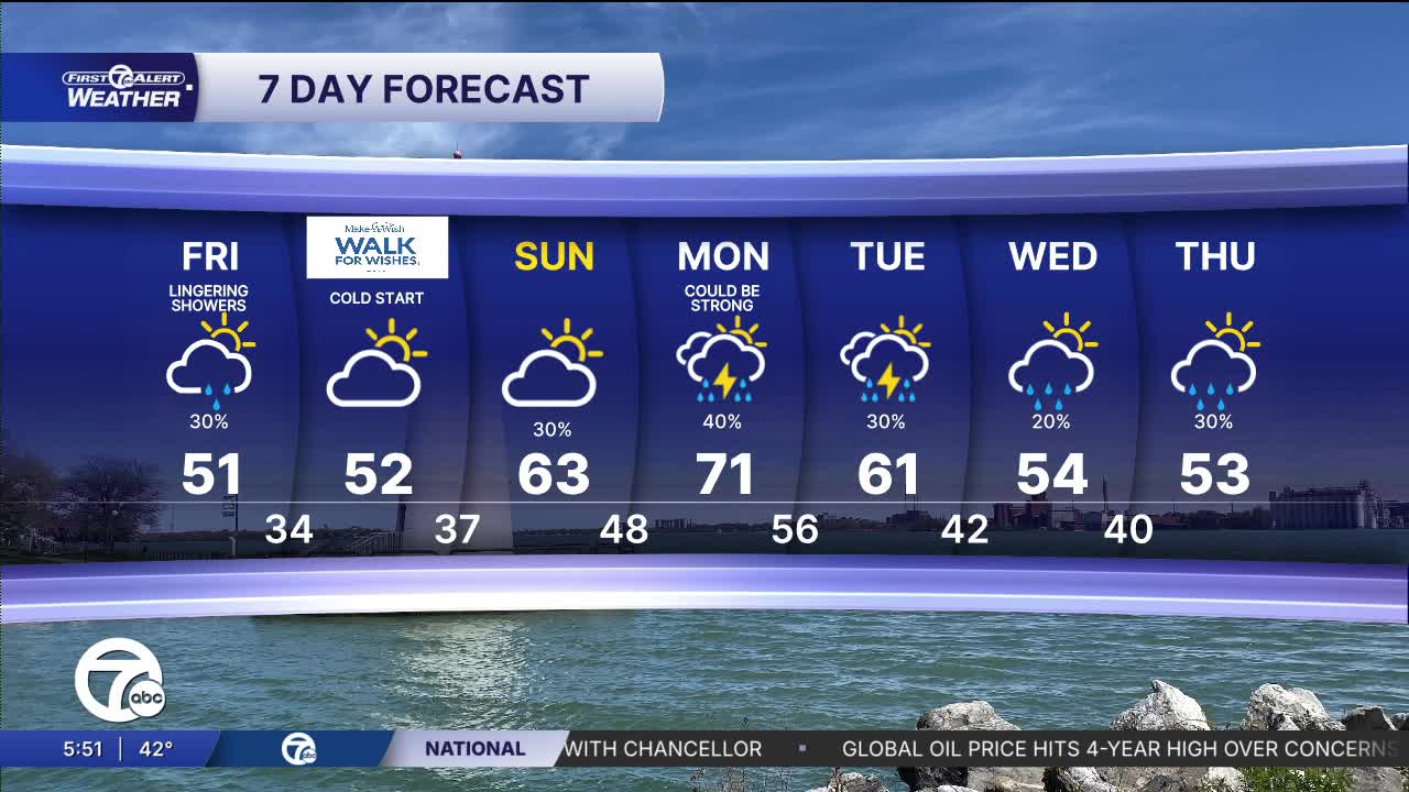
Watch the full forecast in the video below
As we head into tonight, skies begin to clear and that’s when temperatures really start to fall. Lows drop into the low to mid 30s across much of the area, with some colder pockets dipping closer to freezing. Winds stay light out of the north, which helps set the stage for a chilly night.
That leads into a freeze concern by Saturday morning. Many neighborhoods will wake up with temperatures flirting with or just below 32 degrees. If you’ve started planting or have sensitive vegetation out, this is one of those mornings you’ll want to take precautions.
Tomorrow itself looks a bit brighter. We’ll start cold in the upper 30s, but with some breaks of sunshine mixing in, temperatures rebound into the upper 40s to near 50 by the afternoon. Still cool, but noticeably more comfortable than the start.
Looking ahead to the extended forecast, we do warm things up into early next week. Highs push into the 60s and even low 70s by Monday, but that warmth comes with a more active pattern. We’ll bring back chances for showers and even a few thunderstorms, especially Monday into Tuesday. After that, temperatures trend cooler again midweek with lingering rain chances.
Today: Partly sunny with an afternoon shower chance. Highs will be in the low 50s. Winds: NW 10 mph.
Tonight: Clearing skies with temps falling into the low 30s for many. Winds: Light.
Saturday: Partly sunny with an afternoon shower chance. Highs will be in the low 50s. Winds: NW 10 mph.
Sunday: Partly cloudy skies with temps returning to the 60s. SW 10-20 mph.
Connect with 7 First Alert Meteorologists on Facebook and X:
Facebook: Dave Rexroth , Hally Vogel, Marisa Woloszyn, Mike Taylor
